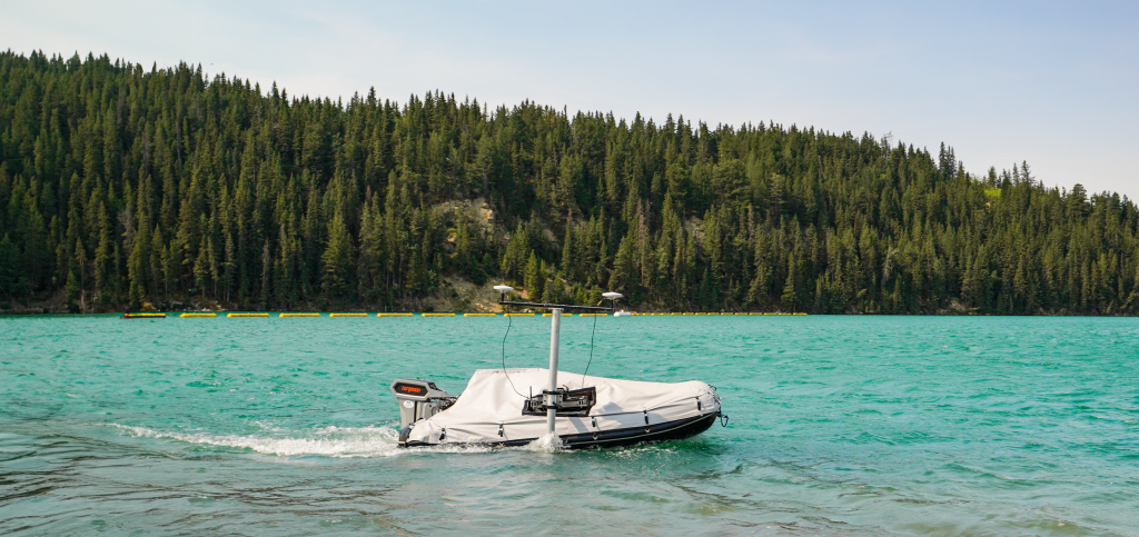
 Autonomous vessels can operate in hazardous environments, such as dams or hydroelectric plants, where human presence may be unsafe. [Vessel courtesy of Measurement Sciences Inc.]
 Over the years, hydrographic surveying has evolved significantly. From lead lines and manual measurements to advanced sonar systems and satellite positioning, technological advancements have greatly enhanced accuracy, efficiency, and safety in data collection.
Autonomous vessels represent the latest innovation in hydrographic surveying. Equipped with autonomous command and control systems, these vessels operate without direct human intervention, allowing super-human precision, increased accessibility, and cost-effectiveness.
An autonomous vessel, also known as an unmanned surface vehicle (USV), is a marine craft that operates independently without the need for direct human control.
Autonomous vessels can theoretically be any size, thanks to retrofit systems that can make any boat autonomous. Currently, these vessels range from as small as one meter to as large as 103 meters in length with varying sensor and payload capacities and can either be designed to be optionally manned or entirely unmanned.
For a more detailed look into maritime autonomy read here.
Autonomous boats are increasingly being used to take over tasks that are dull, dirty, or dangerous for humans.
In hydrographic surveying, this translates to handling repetitive or broad area survey grids, navigating toxic bodies of water, operating in areas with strong currents, and more.
Autonomy in surveying not only enhances safety but also improves efficiency and cost-effectiveness. For instance, projects can be completed faster, and there’s less need for costly interruptions, like (in some cases) shutting down hydroelectric plants to conduct a survey.
This technology is transforming the way hydrographic surveys are performed, making them safer, quicker, and more economical.
 Autonomous vessels can operate in hazardous environments, such as dams or hydroelectric plants, where human presence may be unsafe. [Vessel courtesy of Measurement Sciences Inc.]
Autonomous vessels can efficiently survey large coastal areas, collecting data essential for erosion control, habitat preservation, and flood risk assessment.
Additionally, some remote areas of coastline require larger vessels to get to the jobsite, these larger vessels benefit from launching a low draft, USV at their disposal to do shallow water work.
In oceanographic research, autonomous vessels are used for detailed seabed mapping and the study of marine environments.
With the ability to remain at station for up to weeks rather than hours, autonomous vessels can gather data in remote locations longer than their manned counterparts.
Autonomous vessels are employed in navigation to update charts and ensure safe passage for ships. In dredging operations, they provide accurate surveys of the seabed and are a great tool to reduce the routine and repetitive part of the tasks, helping to plan and monitor dredging activities that maintain navigable waterways, critical infrastructure and economic flow.
Both operations often occur in high-traffic areas, shallow waters, or regions with strong currents, where deploying a manned vessel would be challenging.
USVs streamline offshore construction projects by conducting unmanned bathymetric mapping for site selection, identifying optimal locations for structures like platforms and pipelines. They also gather crucial data on seabed composition, all without the complexities and risks of coordinating manned vessel operations.
During construction, the long endurance of unmanned vessels can also be utilized to continuously monitor the site to ensure that construction activities have not altered the seabed and thereby maintaining the integrity of the structure being built.
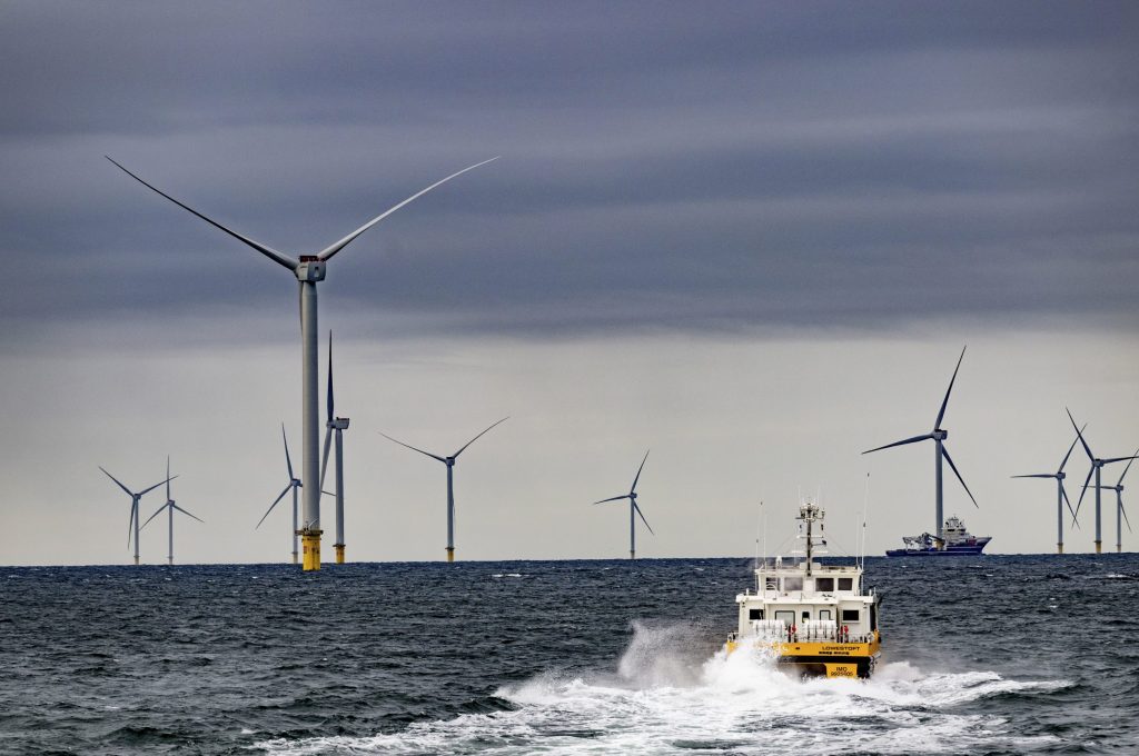
NORTHSEA – Windmill park at sea of VATTENFALL Hollandse Kust Zuid wind farm. It supplies power to more than 1.5 million households. The offshore wind farm consists of 139 wind turbines and is located approximately eighteen kilometers from the coast. THE windmills are located in the sea off the coast of the Netherlands.
Large vessels with high fuel consumption and larger crews are typically required to endure the harsh conditions of offshore wind farms. However, autonomous vessels can perform the same tasks with a smaller carbon footprint and reduced manpower.
For optimum layout of offshore wind turbines, unmanned vessels are deployed to produce highly accurate maps of the seabed that assist in planning the placement of the turbines on stable ground with minimal environmental impact and no interference from subsurface features such as buried cables or geological faults.
After construction, unmanned vessels offer a safer and more cost-effective solution for monitoring seabed erosion around wind turbine foundations, enabling early detection of potential issues and facilitating timely corrective measures.
Charting optimal cable route is an essential part of laying communication or power cables. Autonomous vessels are used to conduct hydrographic surveys to chart the optimal cable route, avoiding underwater hazards, minimizing route length, and ensuring cables are laid on stable seabed conditions.
Over time, seabed conditions can change, potentially exposing or shifting cables. Autonomous vessels can perform regular hydrographic surveys to monitor these changes and ensure the continued protection and integrity of the cables using sub-bottom profilers or side-scan sonars to ensure proper burial depth.
Depending on the specific survey requirements, different types of autonomous vessels are needed to optimize data collection and operational efficiency.
There’s no standard classification for autonomous vessel sizes, and definitions can vary between organizations, but broadly speaking, autonomous vessels can be categorized by size as follows:
Smaller survey vessels are ideal for shallow water and coastal surveys, these small USVs are agile and can navigate tight spaces that larger vessels cannot.
These smaller vessels are often, but not always, powered by renewable energy sources like wind and solar, but their size may limit their payload capacity.
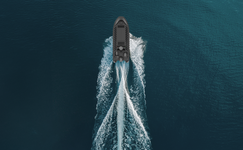
SELKIE 7, the 7 meter autonomous vessel with an integrated cargo bay, Seakeeper gyroscope, and mounts for additional equipment.
Medium-sized survey vessels such as SELKIE 7 are the workhorse of the maritime survey industry, being able to both traverse smaller waterways and withstand harsher open sea conditions.
These vessels are often utilised in surveying coastal areas and wind farms, and are only restricted by their draft, sea state capability, and range.
Their larger size enables them to carry more robust sensors and additional payloads, making them well-suited for longer and more complex operations. However, this increased capacity comes at the cost of higher power requirements and greater deployment challenges compared to smaller USVs.
Sea Machines’ SELKIE class vessel is capable of carrying up to 500 kg (about 1102 lb). payloads in her cargo bay and is built with hydrographic survey in mind with ample room and power for additional sensors. Powered by our SM300 autonomy system, SELKIE provides a turnkey autonomy solution for a wide array of survey operations.
Larger survey vessels offer specific advantages and disadvantages due to their size.
Their spacious design enables them to serve as motherships for smaller autonomous vessels, extend operational range, and endure the harshest maritime conditions.
While these vessels provide unparalleled capabilities for deep-sea exploration, their large scale also makes them the most expensive to operate and deploy.
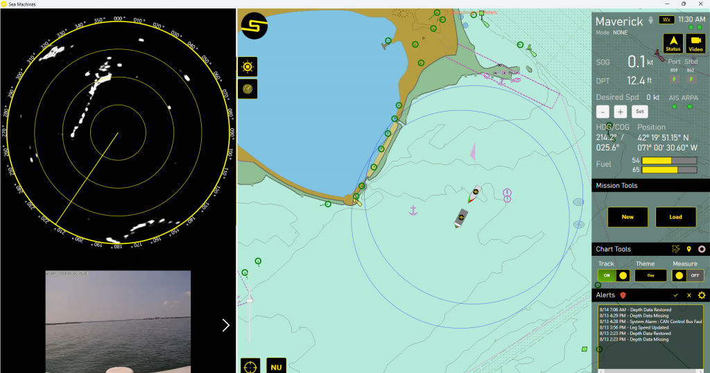
Our SM300 Autonomous Command and Control system provides many features that are beneficial to survey operations.
A second vessel follows the beacon of the SM300 equipped vessel for simultaneous control.
Utilise one or more vessel locked on to the mothership as force multipliers to cover more area with the same amount of effort.
This approach is particularly effective for extensive surveys or operations, as it enables multiple vessels to work in unison under a unified command, ensuring comprehensive coverage while optimizing resource use.
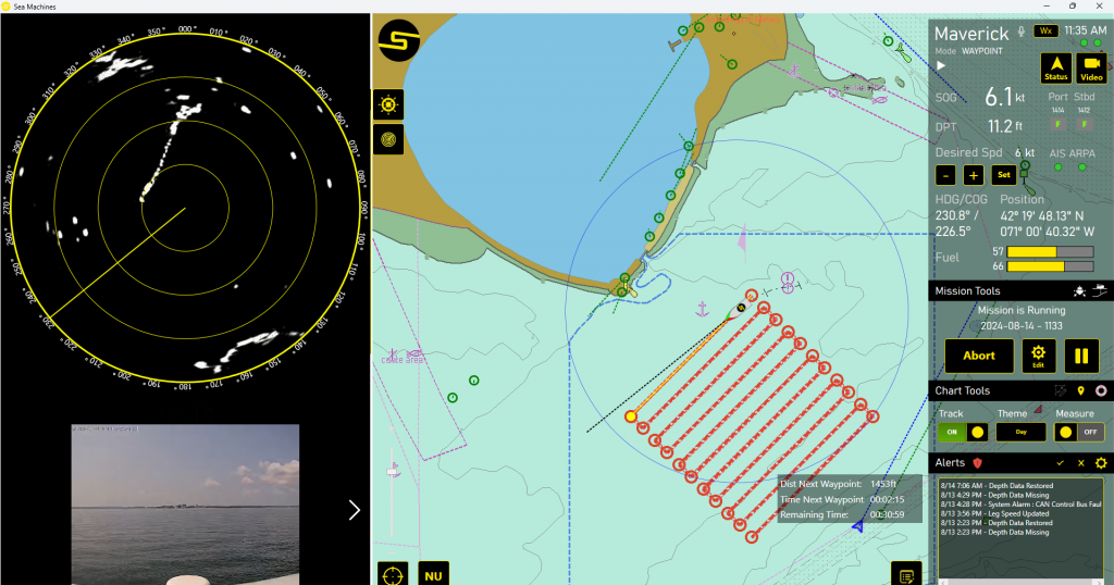 Plotting survey grids on the SM300 UI
Control width, length, rotation, and leg spacing and click to place your survey grid on the SM300 UI, then deploy and collect survey data autonomously. Alternatively, import your survey line plans from either Hypack or QPS QINSy.
The SM300 ensures precise navigation for high-quality survey data every time.
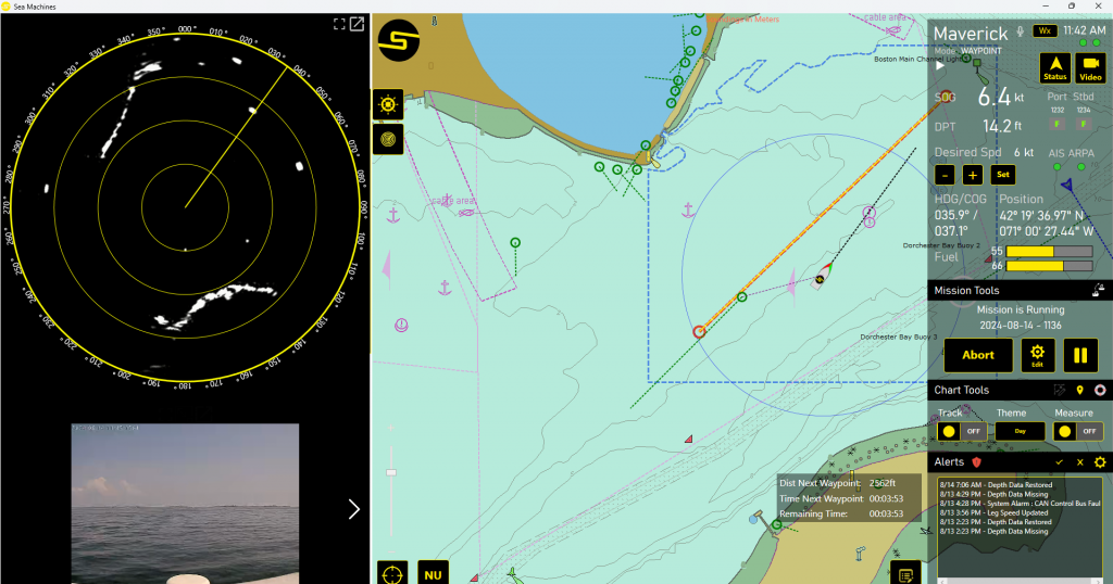 The SM300 autonomously avoids a head-on obstacle.
The SM300 enables the vessel to autonomously avoid, correct course, and continue the mission as planned with custom safeguard distances to suit your needs.
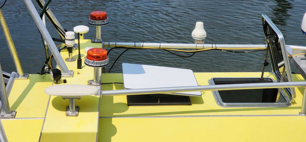 Starlink can assist in accelerating survey data processing times.
By providing robust, low-latency connectivity even in remote or offshore locations, Starlink facilitates real-time data transmission from survey vessels to onshore teams. This enhanced connectivity enables quicker data analysis and reduces delays in data transfer, allowing for processing to begin while the vessel is still on its mission.
Remote Data Processing is enabled with high-bandwidth satellite communications.
Survey companies can process acquired data in parallel with field operations, allowing for much faster turnaround time on deliverables. Remotely based survey data processing staff can be distributed globally, thus taking advantage of time zone differences and potentially reducing costs.
Autonomous vessels can follow pre-programmed routes with minimal deviation ensures consistent data collection, reducing human error and improving the reliability of survey results.
Additionally, the autonomous nature of these vessels enables continuous and repeatable surveys, making them a valuable asset for areas requiring frequent monitoring and repeated surveys over time. This capability allows for accurate tracking of changes in underwater environments.
Autonomous vessels significantly reduce the need for onboard personnel, minimizing labor expenses associated with traditional manned survey operations.
With computer-planned navigation, autonomy also contributes to reducing fuel costs by optimizing routes and ensuring efficient operation, further enhancing the cost-effectiveness of survey missions.
Autonomy is also a boon for survey missions that require broad area coverage, as autonomous vessels are not bound by the time requirements of humans and can provide features that aid in expediting data collection such as collaborative following (see above).
Autonomous vessels reduce the need for human presence in dangerous or inaccessible areas, such as harsh weather conditions, hazardous waters, or regions with high-risk factors, thereby significantly lowering the risk of accidents and injuries.
The ability to control and monitor autonomous vessels remotely allows operators to conduct surveys from a safe distance, further enhancing safety by keeping personnel out of harm’s way while still achieving precise and effective survey results.
Unlike human crews, autonomous vessels can operate continuously without the need for breaks, rest, or shift changes. This uninterrupted operation maximizes efficiency, especially during long or complex survey missions, leading to more productive and cost-effective outcomes.
Combined with instant data transmission via Starlink, autonomy can greatly expedite survey operations.
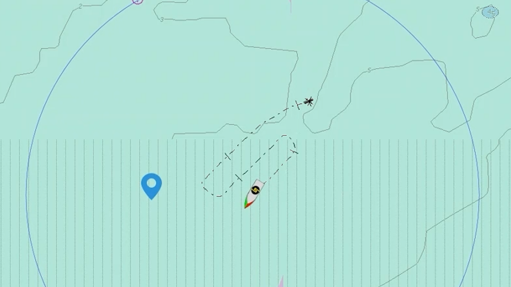
Autonomously run grids exhibit minimal cross-track error.
One of the key advantages of autonomy is its flexibility. You don’t always have to operate fully autonomously to reap the benefits.
Reduced and optionally crewed vessels offer the advantages of autonomy while allowing operators to navigate areas with legal restrictions against full autonomy. They enable decentralized operations and deliver significant ROI by extending operational hours—unhindered by human fatigue—and reducing the costs associated with having a full crew on board.
Autonomous vessels are transforming hydrographic surveying by enhancing accuracy, reducing costs, and improving safety.
Operating without personnel onboard can streamline data collection and processing while simultaneously minimizing human presence in hazardous areas.
Sea Machines proudly offers two advanced solutions: the SM300 Autonomous Command and Control system, available as a retrofit option, and the SELKIE class, our 7- and 9-meter autonomous platform powered by the SM300 system.
Reach out to us at sales@sea-machines.com to explore the right autonomous solution for you.